
Hadley "B" 5 15-051-73678 · Ellis County needs expert review
Document 15-051-73678_DL · 1 page(s) · read with option layout · source scan (KGS).
Click a row to highlight where it was read on the scan. Read-only (Phase 1).
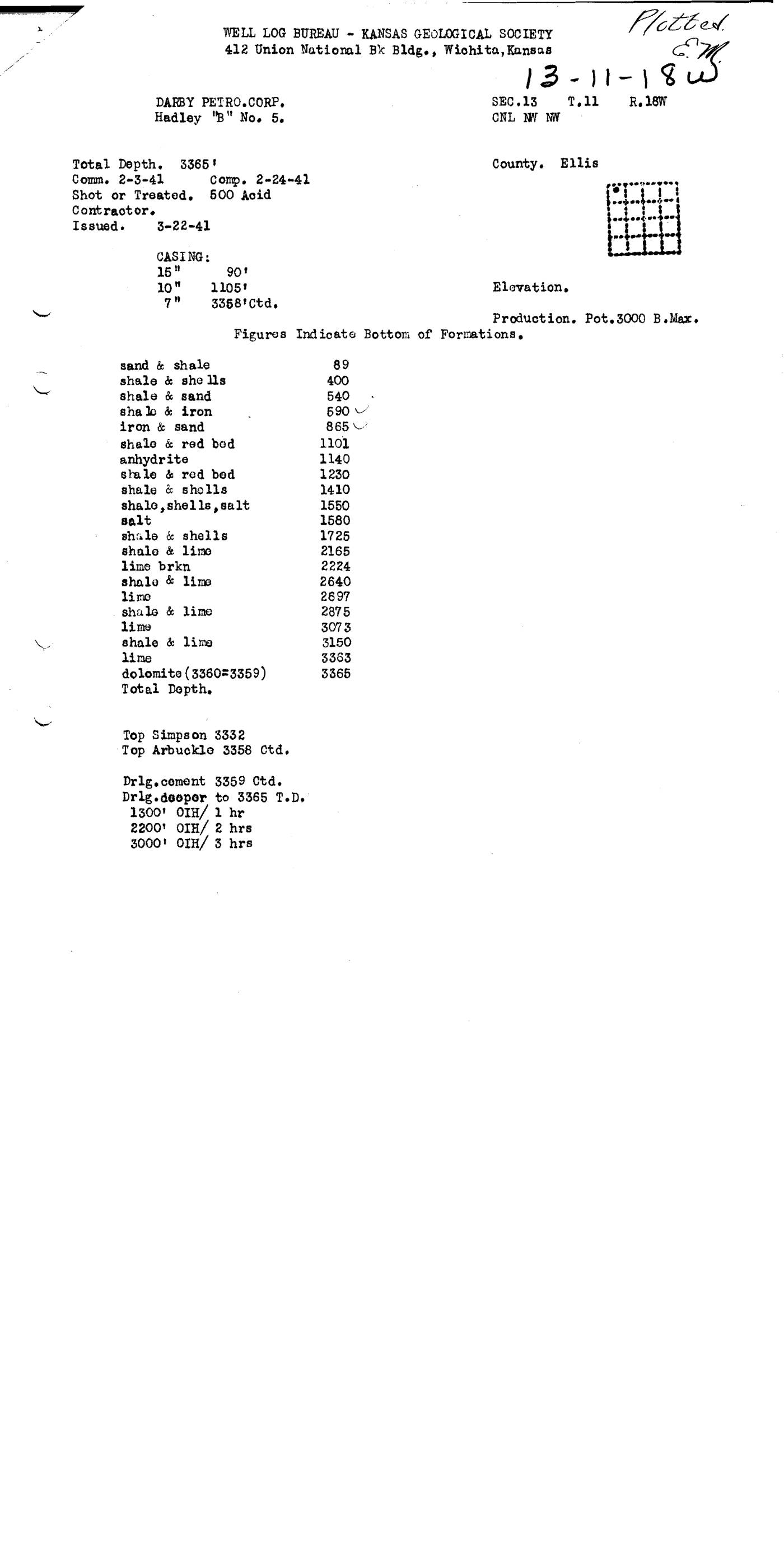 page 1
Extracted fields & KGS master-list cross-check
| Field | Value | Confidence | Page | Snippet | Cross-check |
|---|---|---|---|---|---|
| Document type | driller's log | 1.00 | p. 1 | WELL LOG BUREAU - KANSAS GEOLOGICAL SOCIETY | |
| API number | 15-051-73678 snippet not found in OCR text | 0.70 | p. 1 | Document 15-051-73678_DL | not found |
| Lease | Hadley "B" | 1.00 | p. 1 | Hadley "B" No. 5. | not found |
| Well no. | 5 | 1.00 | p. 1 | Hadley "B" No. 5. | not found |
| Operator | DARBY PETRO.CORP. | 1.00 | p. 1 | DARBY PETRO.CORP. | not found |
| County | Ellis | 1.00 | p. 1 | County. Ellis | not found |
| Location | CNL NW NW SEC.13 T.11 R.18W | 0.95 | p. 1 | SEC.13 T, 11 R. 18W CNL NW NW | not found |
| Section | 13 (as written: CNL NW NW SEC.13 T.11 R.18W) | 0.95 | p. 1 | SEC.13 T, 11 R. 18W CNL NW NW | |
| Township | 11S (as written: CNL NW NW SEC.13 T.11 R.18W) | 0.95 | p. 1 | SEC.13 T, 11 R. 18W CNL NW NW | |
| Range | 18W (as written: CNL NW NW SEC.13 T.11 R.18W) | 0.95 | p. 1 | SEC.13 T, 11 R. 18W CNL NW NW | |
| Spud date | 1941-02-03 (as written: 2-3-41) | 0.95 | p. 1 | Comm. 2-3-41 | not found |
| Completion date | 1941-02-24 (as written: 2-24-41) | 0.95 | p. 1 | Comp. 2-24-41 | not found |
| Plug date | p. 1 | not found | |||
| Elevation KB (ft) | p. 1 | ||||
| Elevation DF (ft) | p. 1 | ||||
| Elevation ground (ft) | p. 1 | ||||
| Elevation, no reference (ft) | p. 1 | not found | |||
| Total depth (ft) | 3365.0 (as written: 3365) | 1.00 | p. 1 | Total Depth. 3365 ' | not found |
| Plugging | p. 1 |
Casing
| Size (in) | Depth (ft) | Cement (sx) | Purpose | Page | Snippet |
|---|---|---|---|---|---|
| 15.0 0.95 | 90.0 0.95 | p. 1 | 15 " 90' | ||
| 10.0 0.95 | 1105.0 0.95 | p. 1 | 10 " 1105' | ||
| 7.0 0.95 | 3358.0 0.95 | p. 1 | 7" 3358'ctd. |
Perforations
None extracted.
Formation tops
| Formation | Depth (ft) | Page | Snippet |
|---|---|---|---|
| sand & shale 0.95 | 89.0 0.95 | p. 1 | sand & shale 89 |
| shale & shells 0.95 | 400.0 0.95 | p. 1 | shale & she lls 400 |
| shale & sand 0.95 | 540.0 0.95 | p. 1 | shale & sand 540 |
| shale & iron 0.95 | 590.0 0.95 | p. 1 | sha le & iron 590 |
| iron & sand 0.95 | 865.0 0.95 | p. 1 | iron & sand 865 |
| shale & red bod 0.95 | 1101.0 0.95 | p. 1 | shele & red bod 1101 |
| anhydrite 0.95 | 1140.0 0.95 | p. 1 | anhydrite 1140 |
| shale & red bed 0.95 | 1230.0 0.95 | p. 1 | shale & red bed 1230 |
| shale & shells 0.95 | 1410.0 0.95 | p. 1 | shale & shells 1410 |
| shale, shells, salt 0.95 | 1550.0 0.95 | p. 1 | shale, shells, salt 1550 |
| salt 0.95 | 1580.0 0.95 | p. 1 | salt 1580 |
| shale & shells 0.95 | 1725.0 0.95 | p. 1 | shale & shells 1725 |
| shale & lime 0.95 | 2165.0 0.95 | p. 1 | shale & limo 2165 |
| lime brkn 0.95 | 2224.0 0.95 | p. 1 | lime brkn 2224 |
| shale & lime 0.95 | 2640.0 0.95 | p. 1 | shalo & lime 2640 |
| lime 0.95 | 2697.0 0.95 | p. 1 | limo 2697 |
| shale & lime 0.95 | 2875.0 0.95 | p. 1 | shale & lime 2875 |
| lime 0.95 | 3073.0 0.95 | p. 1 | lime 3073 |
| shale & lime 0.95 | 3150.0 0.95 | p. 1 | shale & lime 3150 |
| lime 0.95 | 3363.0 0.95 | p. 1 | lime 3363 |
| dolomite (3360=3359) 0.95 | 3365.0 0.95 | p. 1 | dolomite (3360=3359) 3365 |
| Top Simpson 0.95 | 3332.0 0.95 | p. 1 | Top Simpson 3332 |
| Top Arbuckle 0.95 | 3358.0 0.95 | p. 1 | Top Arbuckle 3358 Ctd. |
Tests (DST / IP)
None extracted.
QC flags
| Severity | Rule | Field | Message | Expert review |
|---|---|---|---|---|
| warning | SNIPPET_UNVERIFIED | api_number | api_number: cited snippet not found on page 1 | yes |
| warning | TOPS_ORDER | tops[21] | Top Top Simpson at 3332 ft is shallower than preceding dolomite (3360=3359) at 3365 ft | yes |