
KOESTER BROTHERS 1-10 15-009-25183 · Barton County
Document 15-009-25183_ACO · 6 page(s) · read with option layout · source scan (KGS).
Click a row to highlight where it was read on the scan. Read-only (Phase 1).
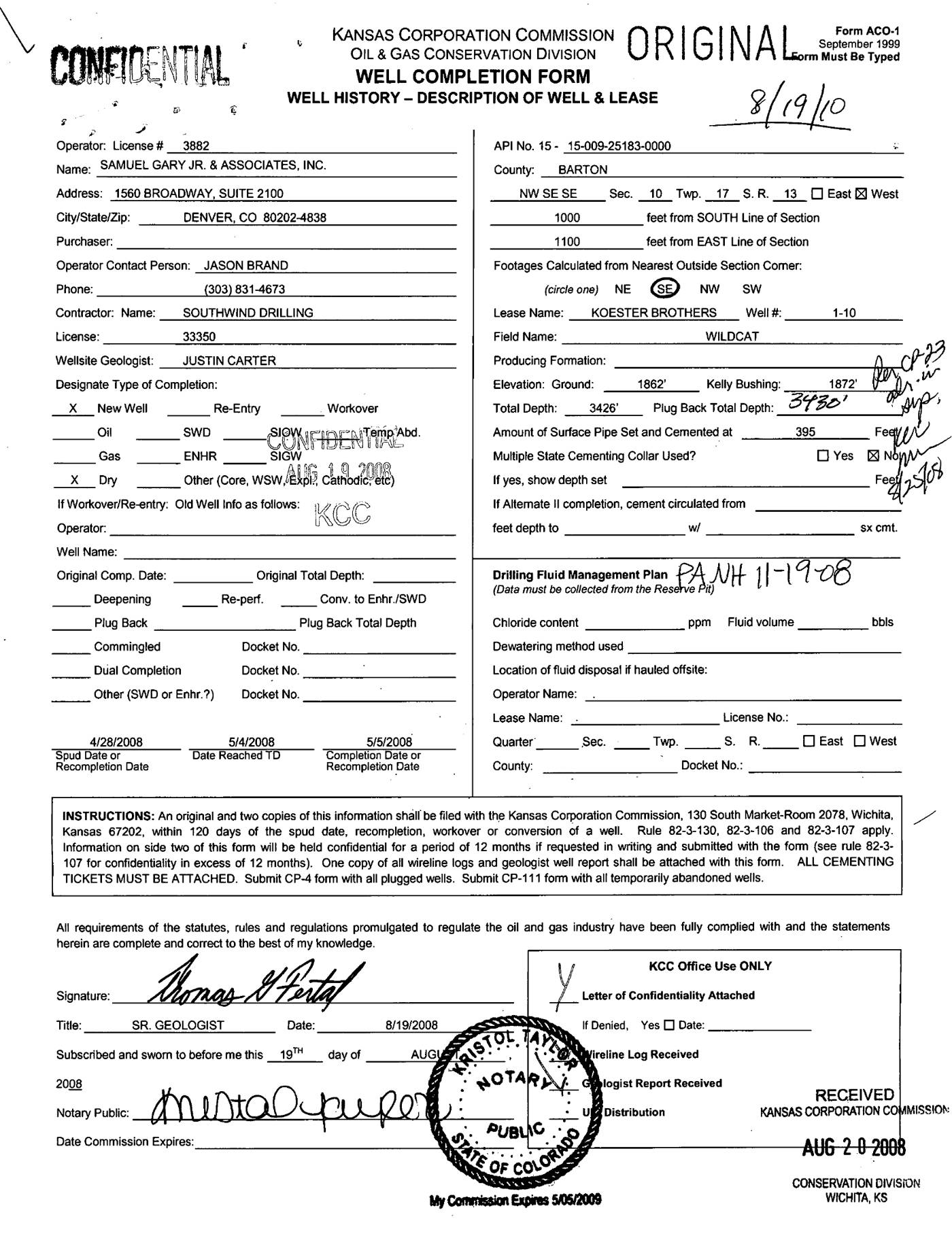 page 1
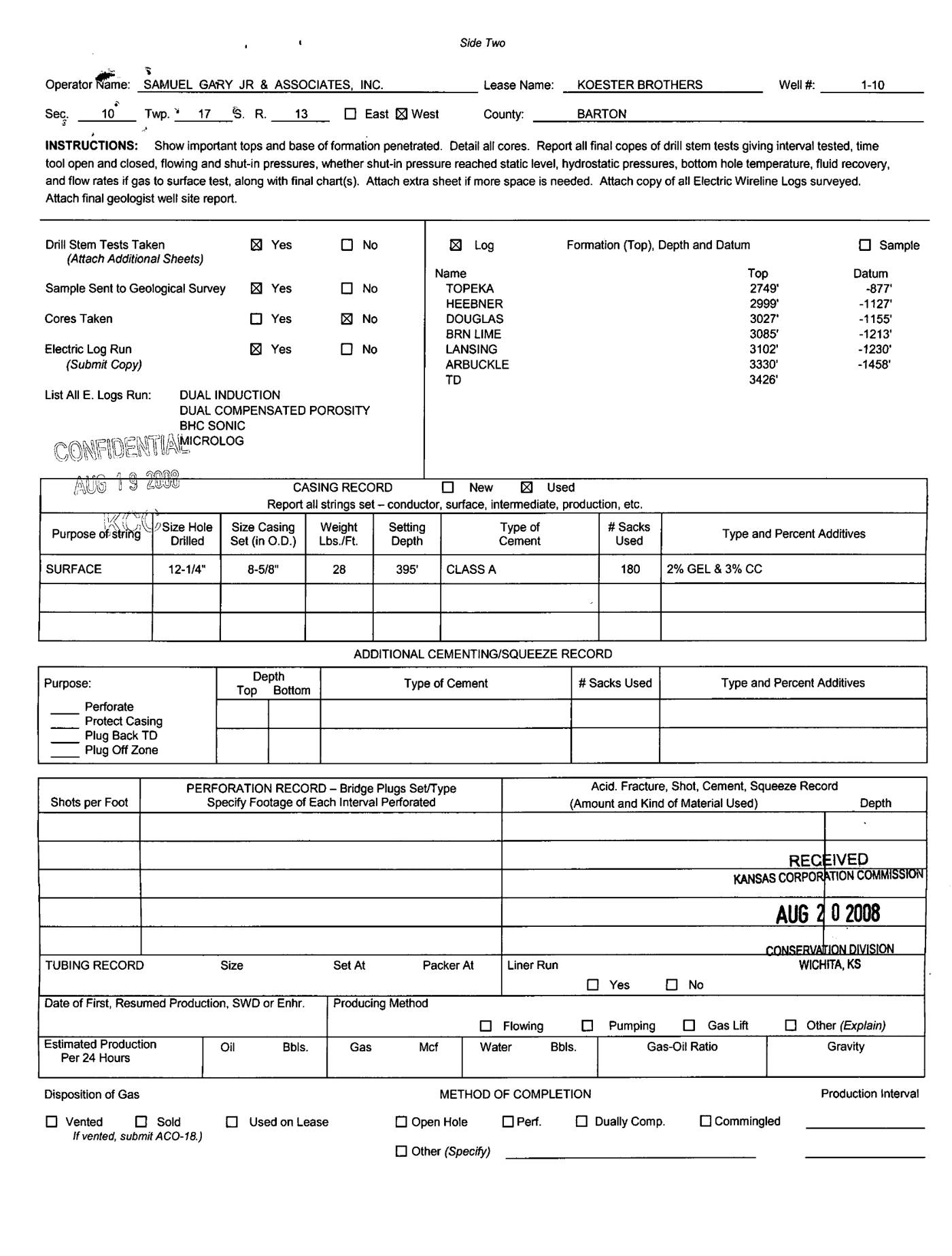 page 2
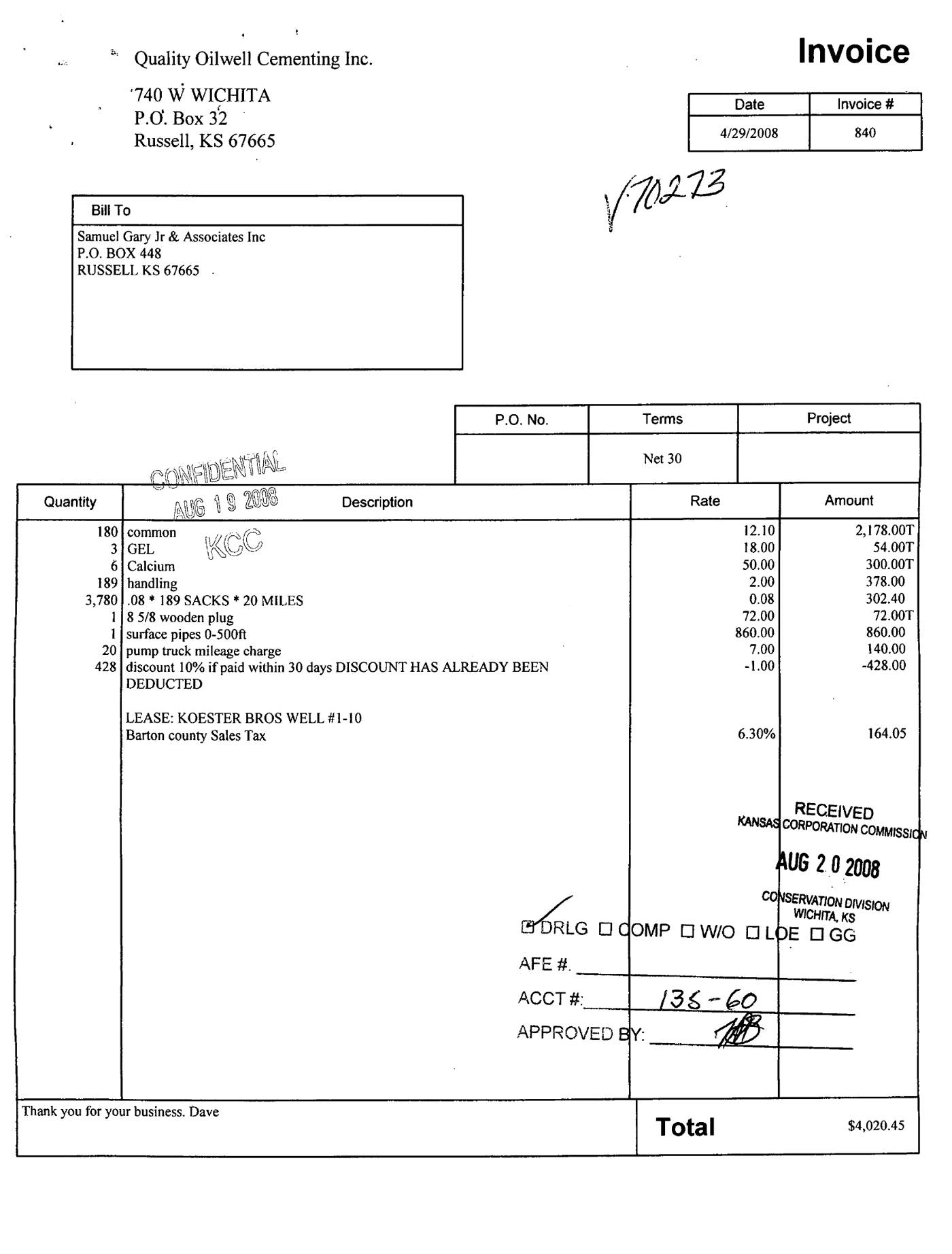 page 3
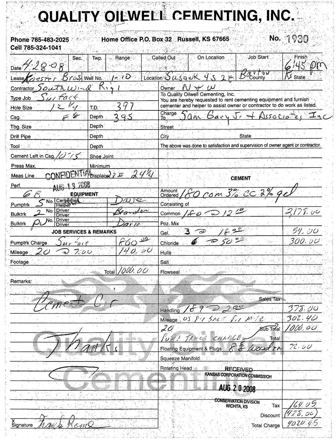 page 4
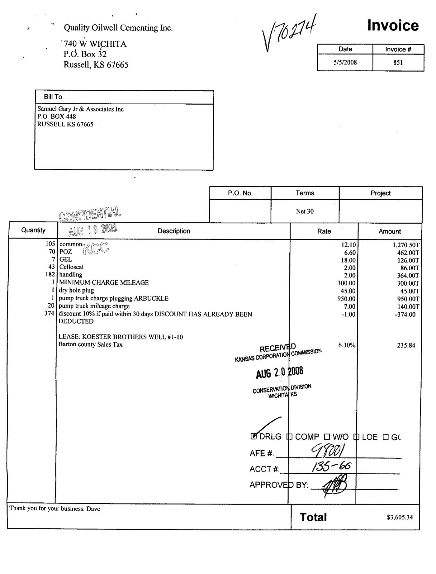 page 5
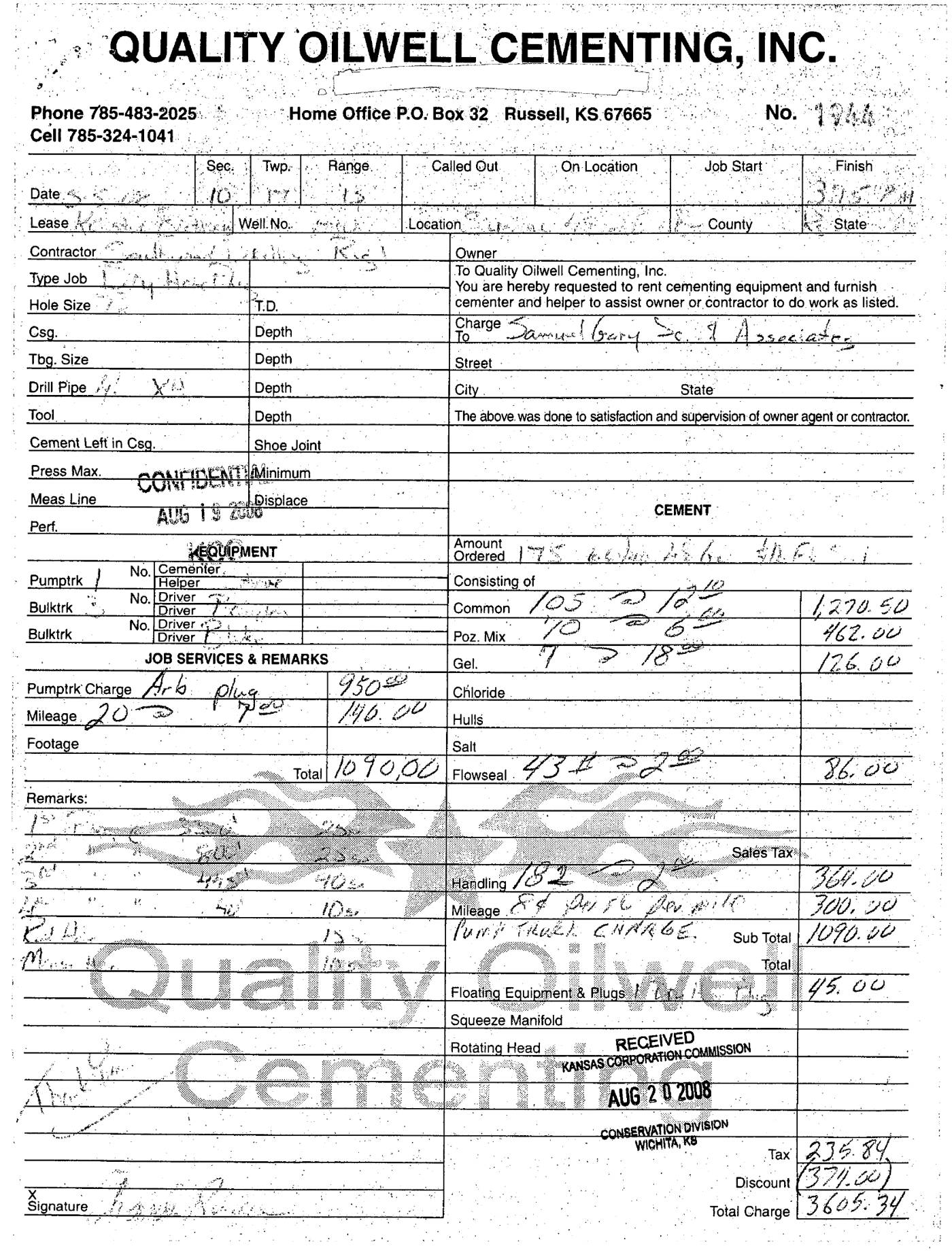 page 6
Extracted fields & KGS master-list cross-check
| Field | Value | Confidence | Page | Snippet | Cross-check |
|---|---|---|---|---|---|
| Document type | well completion form | 1.00 | p. 1 | WELL COMPLETION FORM WELL HISTORY - DESCRIPTION OF WELL & LEASE | |
| API number | 15-009-25183 (as written: 15-009-25183-0000) | 1.00 | p. 1 | API No. 15 - 15-009-25183-0000 | match KGS: 15-009-25183 |
| Lease | KOESTER BROTHERS | 1.00 | p. 1 | Lease Name: KOESTER BROTHERS | match KGS: Koester Brothers |
| Well no. | 1-10 | 1.00 | p. 1 | Well #: 1-10 | match KGS: 1-10 |
| Operator | SAMUEL GARY JR. & ASSOCIATES, INC. | 1.00 | p. 1 | Operator: License # 3882 Name: SAMUEL GARY JR. & ASSOCIATES, INC. | match KGS: Samuel Gary Jr. and Assoc., Inc. / Samuel Gary Jr. & Associates, Inc. |
| County | Barton (as written: BARTON) | 1.00 | p. 1 | County: BARTON | match KGS: Barton |
| Location | NW SE SE 10-17S-13W 1000 feet from SOUTH Line of Section 1100 feet from EAST Line of Section | 0.95 | p. 1 | NW SE SE Sec. 10 Twp. 17 S. R. 13 East West 1000 feet from SOUTH Line of Section 1100 feet from EAST Line of Section | match KGS: 10-17S-13W |
| Section | 10 (as written: NW SE SE 10-17S-13W 1000 feet from SOUTH Line of Section 1100 feet from EAST Line of Section) | 0.95 | p. 1 | NW SE SE Sec. 10 Twp. 17 S. R. 13 East West 1000 feet from SOUTH Line of Section 1100 feet from EAST Line of Section | |
| Township | 17S (as written: NW SE SE 10-17S-13W 1000 feet from SOUTH Line of Section 1100 feet from EAST Line of Section) | 0.95 | p. 1 | NW SE SE Sec. 10 Twp. 17 S. R. 13 East West 1000 feet from SOUTH Line of Section 1100 feet from EAST Line of Section | |
| Range | 13W (as written: NW SE SE 10-17S-13W 1000 feet from SOUTH Line of Section 1100 feet from EAST Line of Section) | 0.95 | p. 1 | NW SE SE Sec. 10 Twp. 17 S. R. 13 East West 1000 feet from SOUTH Line of Section 1100 feet from EAST Line of Section | |
| Spud date | 2008-04-28 (as written: 4/28/2008) | 1.00 | p. 1 | Spud Date or Recompletion Date 4/28/2008 | match KGS: 28-APR-2008 |
| Completion date | 2008-05-05 (as written: 5/5/2008) | 1.00 | p. 1 | Completion Date or Recompletion Date 5/5/2008 | match KGS: 05-MAY-2008 |
| Plug date | p. 1 | missing extracted KGS: 05-MAY-2008 | |||
| Elevation KB (ft) | 1872.0 (as written: 1872') | 1.00 | p. 1 | Kelly Bushing: 1872' | match KGS: 1872 KB |
| Elevation DF (ft) | p. 1 | ||||
| Elevation ground (ft) | 1862.0 (as written: 1862') | 1.00 | p. 1 | Elevation: Ground: 1862' | |
| Elevation, no reference (ft) | p. 1 | ||||
| Total depth (ft) | 3426.0 (as written: 3426') | 1.00 | p. 1 | Total Depth: 3426' | match KGS: 3430 |
| Plugging | p. 1 |
Casing
| Size (in) | Depth (ft) | Cement (sx) | Purpose | Page | Snippet |
|---|---|---|---|---|---|
| 8.625 1.00 | 395.0 1.00 | 180.0 1.00 | SURFACE 1.00 | p. 2 | Size Casing Set (in O.D.) 8-5/8" |
Perforations
None extracted.
Formation tops
| Formation | Depth (ft) | Page | Snippet |
|---|---|---|---|
| TOPEKA 1.00 | 2749.0 1.00 | p. 2 | TOPEKA |
| HEEBNER 1.00 | 2999.0 1.00 | p. 2 | HEEBNER |
| DOUGLAS 1.00 | 3027.0 1.00 | p. 2 | DOUGLAS |
| BRN LIME 1.00 | 3085.0 1.00 | p. 2 | BRN LIME |
| LANSING 1.00 | 3102.0 1.00 | p. 2 | LANSING |
| ARBUCKLE 1.00 | 3330.0 1.00 | p. 2 | ARBUCKLE |
| TD 1.00 | 3426.0 1.00 | p. 2 | TD |
Tests (DST / IP)
None extracted.
QC flags
No QC flags.