
Autumn 1 15-009-24480 · Barton County
Document 15-009-24480_ACO · 1 page(s) · read with option layout · source scan (KGS).
Click a row to highlight where it was read on the scan. Read-only (Phase 1).
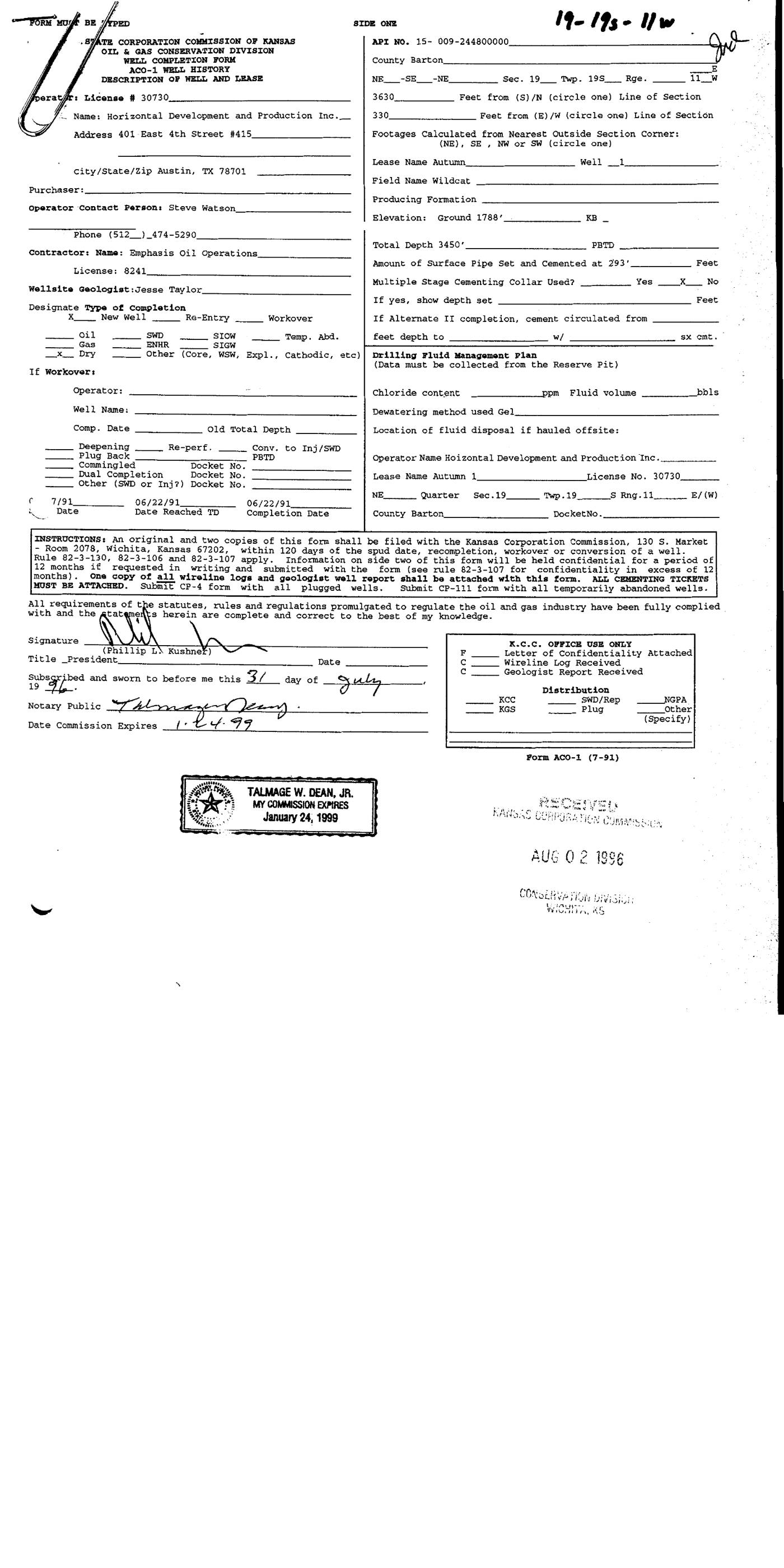 page 1
Extracted fields & KGS master-list cross-check
| Field | Value | Confidence | Page | Snippet | Cross-check |
|---|---|---|---|---|---|
| Document type | well completion form | 0.98 | p. 1 | WELL COMPLETION FORM ACO-1 WELL HISTORY DESCRIPTION OF WELL AND LEASE | |
| API number | 15-009-24480 | 0.97 | p. 1 | API NO. 15- 009-244800000 | match KGS: 15-009-24480 |
| Lease | Autumn | 0.97 | p. 1 | Lease Name Autumn Well 1 | match KGS: AUTUMN |
| Well no. | 1 | 0.97 | p. 1 | Lease Name Autumn Well 1 | match KGS: 1 |
| Operator | Horizontal Development and Production Inc. | 0.97 | p. 1 | Name: Horizontal Development and Production Inc. | match KGS: HORIZONTAL DEVEL & PROD INC / Horizontal Development & Production, Inc. |
| County | Barton | 0.97 | p. 1 | County Barton | match KGS: Barton |
| Location | NE Sec. 19 Twp. 19S Rge. 11W 3630 Feet from (S) 330 Feet from (E) | 0.95 | p. 1 | NE Sec. 19 Twp. 19S Rge. 11W 3630 Feet from (S) /N (circle one) Line of Section 330 Feet from (E) /W (circle one) Line of Section | match KGS: 19-19S-11W |
| Section | 19 (as written: NE Sec. 19 Twp. 19S Rge. 11W 3630 Feet from (S) 330 Feet from (E)) | 0.95 | p. 1 | NE Sec. 19 Twp. 19S Rge. 11W 3630 Feet from (S) /N (circle one) Line of Section 330 Feet from (E) /W (circle one) Line of Section | |
| Township | 19S (as written: NE Sec. 19 Twp. 19S Rge. 11W 3630 Feet from (S) 330 Feet from (E)) | 0.95 | p. 1 | NE Sec. 19 Twp. 19S Rge. 11W 3630 Feet from (S) /N (circle one) Line of Section 330 Feet from (E) /W (circle one) Line of Section | |
| Range | 11W (as written: NE Sec. 19 Twp. 19S Rge. 11W 3630 Feet from (S) 330 Feet from (E)) | 0.95 | p. 1 | NE Sec. 19 Twp. 19S Rge. 11W 3630 Feet from (S) /N (circle one) Line of Section 330 Feet from (E) /W (circle one) Line of Section | |
| Spud date | 1991-06-22 (as written: 06/22/91) | 0.97 | p. 1 | 7/91 06/22/91 06/22/91 Date Date Reached TD Completion Date | mismatch KGS: 14-JUN-1991 |
| Completion date | 1991-06-22 (as written: 06/22/91) | 0.97 | p. 1 | 7/91 06/22/91 06/22/91 Date Date Reached TD Completion Date | match KGS: 22-JUN-1991 |
| Plug date | p. 1 | missing extracted KGS: 22-JUN-1991 | |||
| Elevation KB (ft) | p. 1 | ||||
| Elevation DF (ft) | p. 1 | ||||
| Elevation ground (ft) | 1788.0 (as written: 1788) | 0.97 | p. 1 | Elevation: Ground 1788' KB | |
| Elevation, no reference (ft) | p. 1 | missing extracted KGS: 1793 KB | |||
| Total depth (ft) | 3450.0 (as written: 3450) | 0.97 | p. 1 | Total Depth 3450' PBTD | mismatch KGS: 3400 |
| Plugging | p. 1 |
Casing
| Size (in) | Depth (ft) | Cement (sx) | Purpose | Page | Snippet |
|---|---|---|---|---|---|
| 293.0 0.95 | Surface 0.90 | p. 1 | Amount of Surface Pipe Set and Cemented at 293' Feet |
Perforations
None extracted.
Formation tops
None extracted.
Tests (DST / IP)
None extracted.
QC flags
No QC flags.